The "Cave to Cave" is an iconic trip that mainly 4WD, Motorbike riders, and a few gravel/MTB riders know and talk about. The Classic Cave to Cave trail begins at Jenolan Caves and travels along fire trails through the Blue Mountains National Park around Mount Werong and ultimately Wombeyan Caves. I had always wanted to do it from Mt Victoria to Mittagong in one day - approximately 210kms.

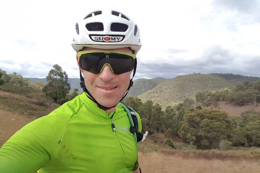
in Autumn 2019, as my son's birth was approaching, the freedom and time to do this sort of thing was quickly running out, so I booked in a date, and committed by doing a couple of long rides in the weeks before. I set up my gravel bike with heaps of spares, installed large seat and handlebar bags with all the gear needed for such a remote trip like spares, tyre plugs, waterproof clothes, heaps of food and water and an emergency beacon. I did a test commute to work and back with all the gear loaded up the day before.
Although the weather reports looked fine all week, on Friday night things looked bleak. Rain, and a solid SSE wind (headwind all day) would mean for a tough day.
I set the alarm for 3:45am to get the 4:36 train from Strathfield. I woke up no problem, but could hear the rain, so lay there in bed having an internal struggle for 5 minutes or so about going or not going.
I bit the bullet and headed out to Strathfield to catch the train. It was a 2 hour trip. The rain backed off, on the way over the mountains, but the time the train pulled up at Mt Victoria it was bucketing down again. I had another very similar internal struggle, questioning my choices, but agreed that although it could be a really stupid idea, and a very long day out, it had to be done.
I carefully descended Victoria Pass straight away in the freezing, wet conditions. Everything was numb. The temperature dropped even more at the bottom of the pass, and it felt pretty unsafe with all the trucks and cross-winds. By the time I got down to Hartley, and swung left onto Cox's River road toward Jenolan caves, the weather started improving to just a drizzle. I could now see the Garmin, and the high average speed from all the descending made me feel a bit better about the whole thing. Progress.
I put the tunes on, and tapped away with a nice rhythm to Jenolan Caves and things got really good. The banana bread and triple shot flat white at the cafe had to be quick as it was cold, and the skies were about to open up. I took about 30 seconds to admire the incredible rock formations of the caves.
The 400m vertical (12-15%) climb out of Jenolan Caves is brutal, especially with a full stomach, and full bottles. It's even worse with aggressively treaded 700 x 40c gravel tyres and soaking wet roads. I wanted to stand up and pedal, but there was no traction. The emotional roller coaster continued.
The Central Tablelands high country around Oberon is one of my favourite parts of NSW, and this was the real sweet spot of the ride. No traffic, gently undulating near perfect gravel roads & heaps of wildlife. The 105km halfway point was in sight, so the mental 'chunking' exercises began to keep motivation high.
As I passed "Jinkin", "Jaunter", and "Shooters Hill" (tiny remote places most will never hear of, let alone visit), I thought about stuff - important stuff that often gets put on the back shelf in the daily grind like family, friends, relationships, the prospect and gravity of being a parent. There's something about being so small and vulnerable out there that I find brings the most important things to mind. It's almost like a factory reset or calibration for the mind.

After half-way the weather temporarily improved, but the fatigue started setting in. I stopped at the Mount Werong campground and had lunch. I wasn't really hungry, but knew as soon as I went over that 4-5hr ride time, my metabolism would go into some sort of crisis mode. It was raining again at this stage, and the most remote and rugged part of the ride was approaching, ie. I was in the 100km stretch of the ride that has no water, food, or phone service, so cue the fear and anxiety (all part of the experience).
At this stage, I had done 130kms, and I had around 80kms to go (or so I thought). It was raining hard now, and I was getting tired and a little frustrated. The track wasn't really a fire trail any more - a bit more like an overgrown 4WD track. Small things were annoying me like not seeing the large holes in the road, because they were filled with water the same colour as the trail. I ploughed into a few of them pretty hard. Vision was terrible, and my Garmin pre-loaded route arrows kind of went missing. After a long fast descent, I stopped under a big gumtree to get out of the rain and cleaned the Garmin screen to realise I had missed an important left hand turn 5kms back. I had to make the decision - backtrack up this 250m vertical hill, or do 15-20 extra flatter kms along the Taralga valley to link back up with where I was meant to be (Wombeyan Caves). It was like one of those "would you rather" games - would you rather lose all of your possessions or lose one of your organs ? I swore a bit, threw a rock into the bush, then pushed ahead with the extra "flatter" kms.
200m after I rolled off into the driving rain and block headwind, my seat bag's velcro gave way, fell off, then got tangled up in my back wheel. I got off, kicked it as hard as I could down the trail, swore some more (and louder this time), went and picked it up, then fixed it and got back on the hunt shaking my head.
I finally made it to Wombeyan Caves, behind schedule, but back on track and a little closer to civilisation. I stopped at the Caravan Park Kiosk, and had a couple of Cliff bars. The nice old lady from the shop asked me where i was riding to, and after i told her Mittagong she laughed and called me a psycho for doing it on a pushbike without a motor. I agreed. I didn't let the conversation go to where i'd started the ride from and how far i'd come already. I'd given her enough to process already, and we didn't have time or bandwidth for that.
I bought two 600m bottles of coke for the final difficult 70kms which would include a steep climb out if the Caves, then later on - the mega 20km/800 vertical meter beast up to the Southern Highlands from the Wollondilly River. Before that though, there was an incredible 12km descent from the Caves with spectacular views in all directions. The weather had cleared up, and there was even some glimpses of sun. Everything was good again. For now..

I battled my way up the climb in all sorts of pain and agony, but knowing that there was only 35kms of sealed road to go once I crestead the Wollondilly lookout. I arrived at the Mittagong AirBnb a broken unit.
My wife Jen met me there and had a cold beer in the fridge and a box of Pringles. This made things ok again.
It was a huge day, which I'll remember by all the suffering, the feelings of pain, vulnerability, elation, but most of all accomplishment.
We had dinner at the local pub in Mittagong that night and although my whole body was aching, it was really nice to share a nice bottle of wine and a meal together before there would be three of us at the table.
The next day we drove back home via Jen's birthplace - Crookwell which is a beautiful little country town near Goulburn.
Stats:
- Distance: 228.93km
- Ride Time: 9:43:04
- Elapsed Time: 11:03:40
- Elevation: Approx. 4000m
- Average Speed: 23.6km/h (Max 63.0km/h)
- Average Heart Rate: 127bpm (Max 167bpm)
- Calories: 5,557
- Average Temperature: 12 °C
- Bike: Trek Checkpoint with Sram Force Hydro Groupset
- Tyres: WTB Nano Tubeless 40psi (no punctures)
- Computer: Garmin 1030
More Details: https://www.strava.com/activities/2216159001